Gamal
Sudan, Waha Irrigation Project

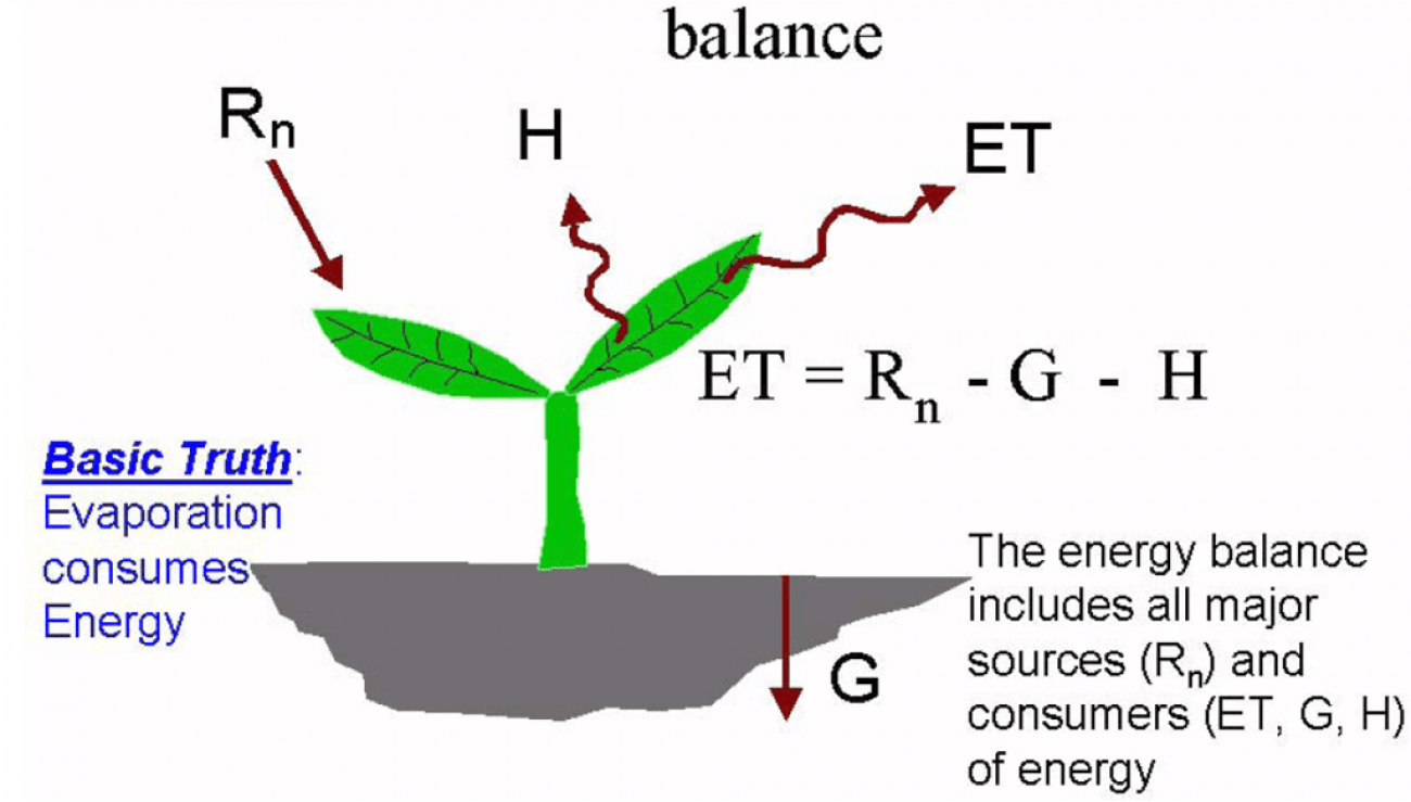
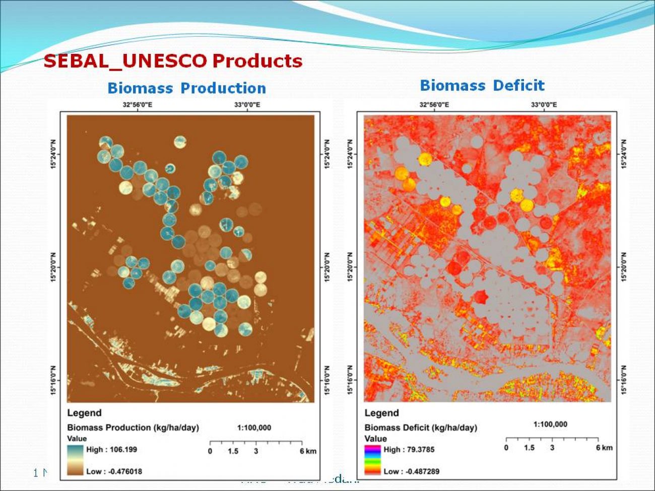
He uses the Using Surface Engergy Balange Algorithm for Land (SEBAL) which he explains is based on the ‘basic truth” that “Evaporation consumes energy” to convert satellite/meteo data into maps displaying Evapotranspiration and Biomass growth for any desired part (or whole) of the 170*185 km covered by the satellite image.

For every 30m x30m pixel on the map a value is calculated. Through another script which integrates the values for biomass growth for different image over the year or season, and when using appropriate correction factors for moist in the harvested crop and straw/non grain biomass, the yield can be calculated.

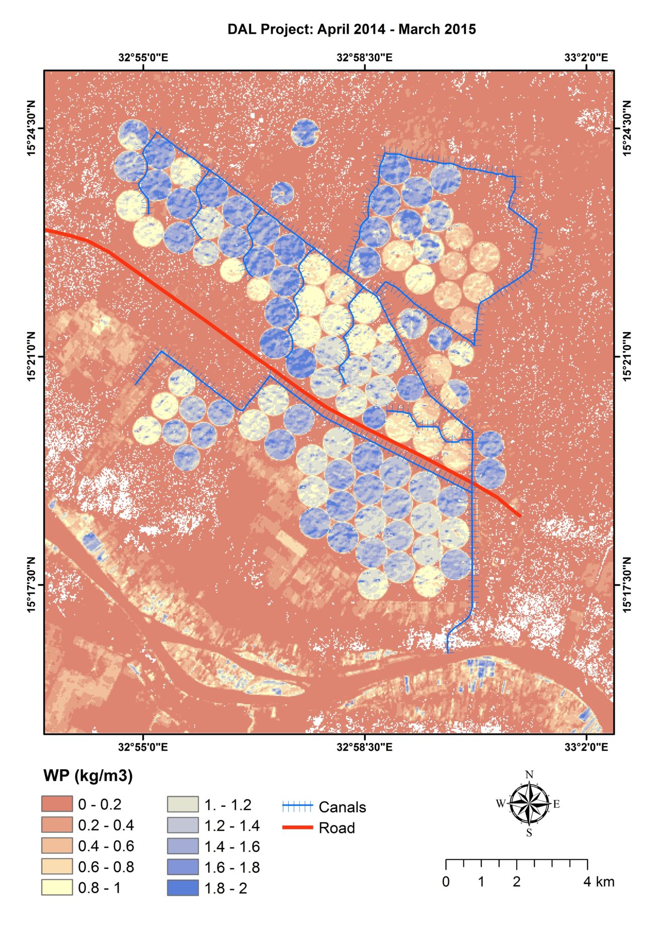
In this way the ‘yield gap’ comes into view. The ‘yield gap’ is loosely defined as the difference between possible yields and actual yields, is visible on the map Gamal made of the Waha scheme. The circles of the high tech pivot irrigation scheme with a biomass production of 18 ton/ha are in marked contrast with the fields of smallholder cultivators south of the scheme and the lands they use for grazing.

When discussing how the assumptions, selections, involved in the making of the Yield Gap of the map might imply particular solutions, while fundamental problems that cause the yield gap might remain unaddressed, he claims the facts he present on the maps form the “input for decisions by policy makers”. He points out that in the end, smallholders too can benefit from their work as it could inform new rehabilitation programmes for example in the Gezira scheme. He understands very well that his maps of water and value are of limited currency in the current political context of land grabs and forced displacement. Yet for him the maps carry promises of new linkages, between FAO, foreign embassies and private companies which in the end might grow so powerful that they might bring big positive change to the country.

